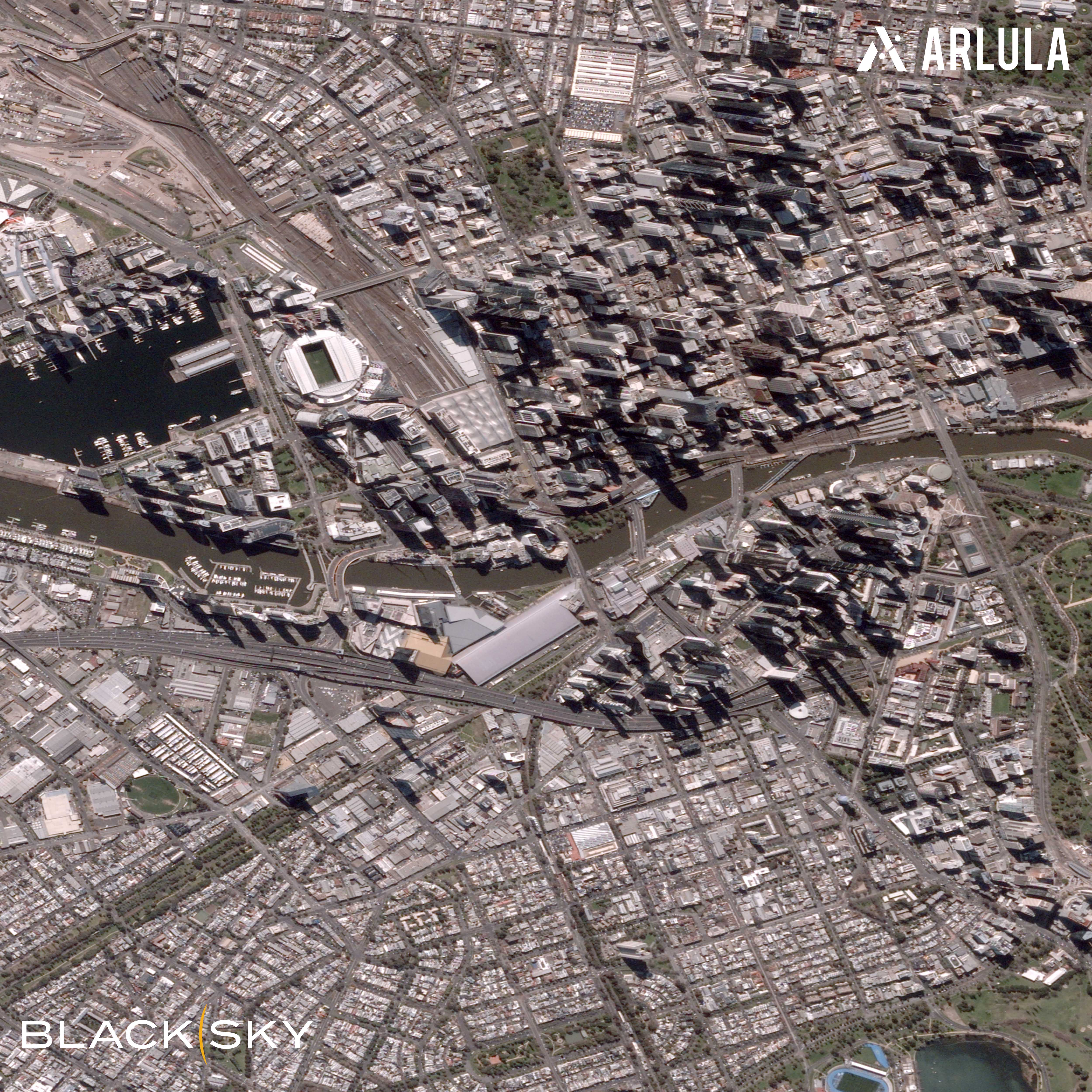
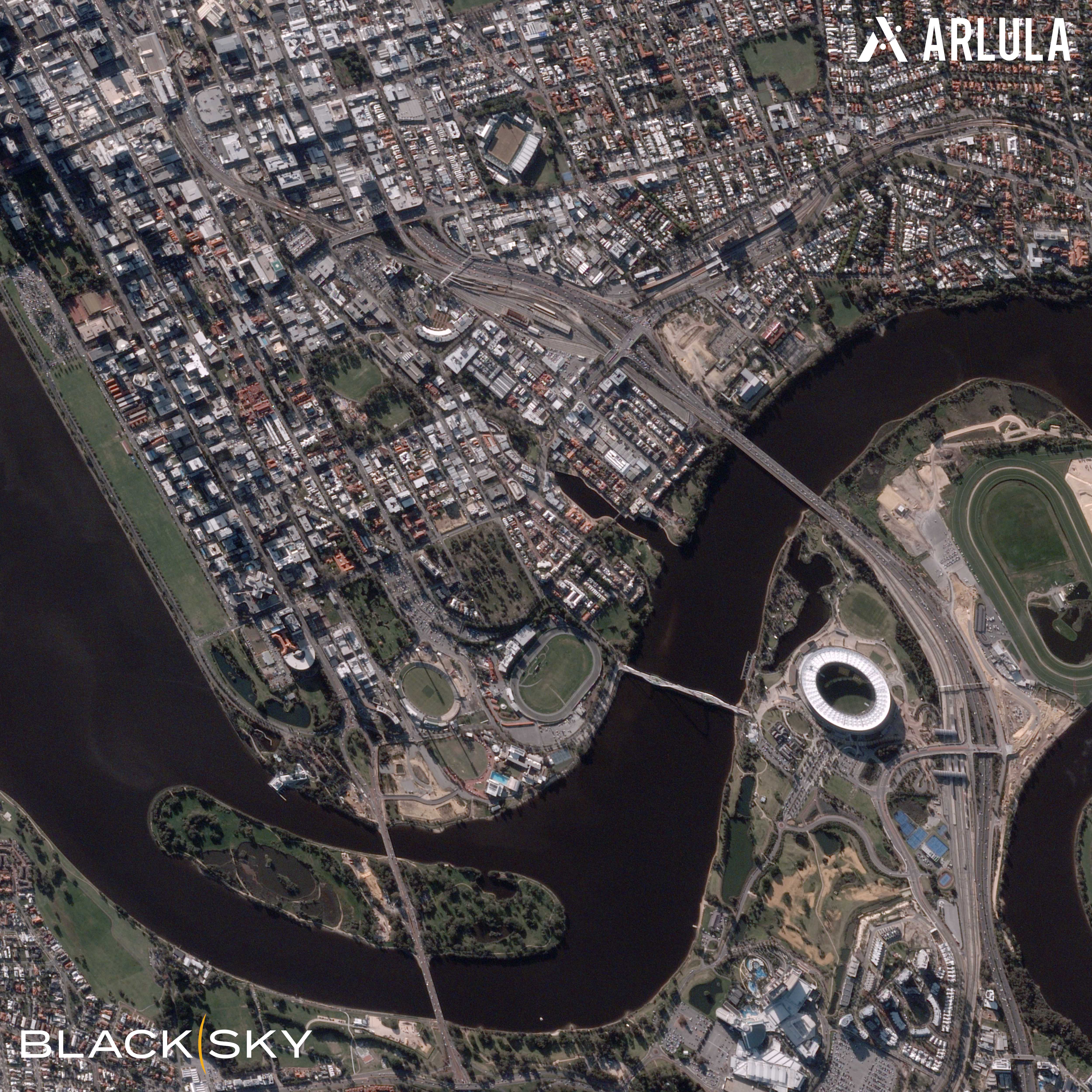
Space technology, and the data provided by satellites, is adding a new dimension to the way urban areas are planned, and how growth issues are addressed.
Our world is urbanising rapidly. Space offers tools and insights to monitor and mitigate the environmental impact made by the growing human population.
A data-driven and analytics approach is essential to mitigating risks into the future. Space tools are enabling cities to become more sustainable and resilient. For example, satellite imaging and remote sensing is providing key insights to inform important planning decisions.
Here are some examples of how urban planning practices are being transformed, with the help of space technology:
Earth observation satellites offer a bird’s eye view of the evolving urban environment. They help urban planners monitor land use. Satellite images highlight the environmental impacts of growth and urbanisation. These images can help predict future growth trends and form strategic plans for zoning and construction projects. Urban planners can use these images to identify the best locations for new developments.
Remote sensing collects important environmental data about air, water quality and other elements that determine how liveable a city is. Urban areas can become significantly warmer than surrounding regional areas due to denser levels of human activity. This phenomenon is called the “urban heat island” effect. Remote sensors can detect and map temperature variations of concern. This helps urban planners work to mitigate impacts such as increased energy consumption, water pollution and adverse effects on native flora and fauna. They may also look to make decisions around building materials, such as using light coloured reflective design panelling and implementing energy-efficient practices.
Global Positioning Systems (GPS) and Global Navigation Satellite Systems (GNSS) offer precise location data to track and manage traffic. This technology, commonly used for directions, offers many important insights. Examples include mapping cities and identifying gaps in infrastructure. The insights can be used to pinpoint traffic congestion areas to plan public transport services or roads.
Urban areas of risk need to built resiliently to withstand severe environmental factors. Satellites can monitor the weather and can help predict natural disasters. Additionally, satellite imaging assists with post-disaster efforts, such as assessing damage and planning for recovery.
Satellite imaging can identify areas of heightened risks before the construction of housing and new infrastructure begins. They can be used to monitor areas subject to hurricanes, earthquakes or flooding. Urban zones can be more prone to flooding, due to a lack of drainage, the presence of large flat paved areas or being built below sea level.
Urban planners, using satellite imaging and remote sensing, can see changes in green spaces over time. They can monitor the health of these green spaces and respond accordingly. This might involve looking to increase green spaces, such as parks for exercise and relaxation, and vegetation on roofs. They can use data provided from satellites to establish goals around per capita green cover of the city. This is highly important, as urbanisation without adequate green space can cause social and physical impacts on residents.
Satellite imaging enables accurate estimates of human-caused light pollution, a growing global problem. This data has provided insights into light on Earth since the 1970s. It helps us follow the evolution of the light pollution threat, without relying on ground-based monitoring and inaccurate measurement equipment on the ground. The images from space highlight that energy is being wasted. They indicate where light pollution may be harming the natural nighttime environment.
Case study: A satellite imagery platform by Arlula
Founded in 2018, Sydney-based startup Arlula is working to make Earth observation data accessible to everyone. They are in partnership with global network of data suppliers and offer bespoke geospatial data management and satellite imagery solutions.
A new market offering
It’s not always possible to monitor buildings and other assets on the ground due to time, cost and practical limitations. Arlula hopes its customers can leverage detailed satellite imagery to:
- Monitor critical and remote infrastructure for a range of industries
- Quickly gather intelligence, either by looking at the present or back into the past
- Understand the impact of environmental changes, natural disasters and urbanisation on the Earth’s surface
- Use unique insights to make efficient data-driven decisions and solve problems on Earth
Satellite imaging can be expensive and time consuming to obtain. Arlula believed many market offerings were falling short and data was presented inconsistently across various platforms. Customers required more efficient tools and a consistent user interface to procure and manage satellite images more effectively.
Satellite images on demand
Arlula operate a satellite imagery database that has an application programming interface (API). The API offers developers the ability to search and order high resolution aerial images quickly on demand. Satellite imagery is obtained from a range of free, government and commercial satellites around the world. The imagery spans several decades.
Arlula is working with a range of companies such as MAXAR, SIIS, Geosat, LatConnect 60 and newer suppliers such as Wyvern, Umbra and Esper. They’re also working with CSIRO and researchers to apply this data to predictive modelling. Advanced algorithms process the satellite imagery data through Arlula’s cloud-based infrastructure so it can be effectively operationalised. Arlula is also partnering with industry and government partners to work with their existing tools to understand capability gaps. Their work has been supported by the Australian Space Agency by means of a Moon to Mars Supply Chain Capability Grant.

Why Space Matters
From keeping us healthy to inspiring us to go beyond the boundaries of what we think is possible, learn how space matters in our everyday lives.


